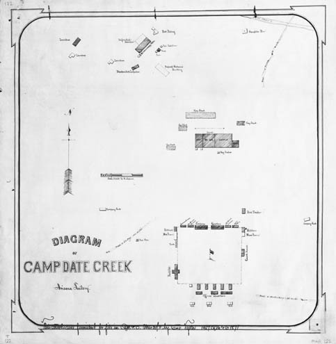
Map 122 -- Camp Date Creek
Detail

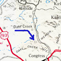
Location
Map 122 -- Camp Date Creek |
Detail |
|
|
|
|
Location |
|
|
|
Order |
| SCALE | 2400 | DATE | 1871 |
|---|---|---|---|
| AUTHOR | Col. Tyler | PUBLISHER | |
| WIDTH X HEIGHT | 16 x 17 in. | FORMAT | |
| PIXELS | 4828 x 4952 | RESOLUTION | 300 dpi |
| DIGITAL FILE | map0122.tif | SIZE & COLOR | 23 Mb grayscale |
| ACCESSION NO. | CALL NO. | Map #122 | |
| LOCATION |
|
Diagram of camp buildings and usage, with roads to Prescott, Wickenburg and La Paz. See also map #160 for map of military reservation surrounding the camp. |
Museum | Archives | Maps |
|