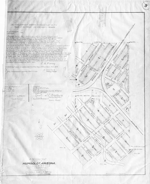
Map 136 -- Humboldt
Detail
Location
Map 136 -- Humboldt |
Detail |
|
|
|
|
Location |
|
|
|
Order |
| SCALE | 2400 | DATE | 1909 |
|---|---|---|---|
| AUTHOR | Merritt, R.L. | PUBLISHER | Arizona Smelting Co. |
| WIDTH X HEIGHT | 16 x 21 in. | FORMAT | |
| PIXELS | 4836 x 5928 | RESOLUTION | 300 dpi |
| DIGITAL FILE | map0136.tif | SIZE & COLOR | 27 Mb grayscale |
| ACCESSION NO. | CALL NO. | Map #136 | |
| LOCATION |
Second amended plat map made by Girand and Latimer for Arizona Smelting Company, owner of the land.
An ambitious plan of about 500 lots clustered around the railroad.
Museum | Archives | Maps |
|