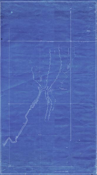
Map 142 -- Confluence of Willow Creek and Granite Creek
Detail
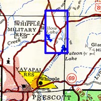
Location
Map 142 -- Confluence of Willow Creek and Granite Creek |
Detail |
|
|
|
|
Location |
|
|
|
Order |
| SCALE | 4800 | DATE | 1911 |
|---|---|---|---|
| AUTHOR | PUBLISHER | ||
| WIDTH X HEIGHT | 21 x 38 in. | FORMAT | Blueprint |
| PIXELS | 6186 x 11100 | RESOLUTION | 300 dpi |
| DIGITAL FILE | map0142.tif | SIZE & COLOR | 200 Mb RGB |
| ACCESSION NO. | CALL NO. | Map #142 | |
| LOCATION |
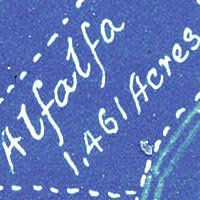
Shows stream courses before the creation of Willow and Watson Lakes. Shows irrigation ditch and agriculture plots.
Museum | Archives | Maps |
|