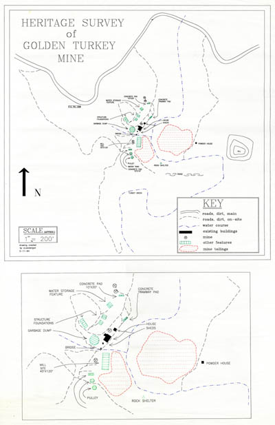
Map 146 -- Golden Turkey Mine
Detail

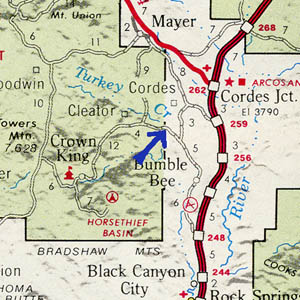
Location
Map 146 -- Golden Turkey Mine |
Detail |
|
|
|
|
Location |
|
|
|
Order |
| SCALE | 2400 | DATE | 1994 |
|---|---|---|---|
| AUTHOR | Vandergon, D. | PUBLISHER | |
| WIDTH X HEIGHT | 24 x 36 in. | FORMAT | color |
| PIXELS | 5998 x 9250 | RESOLUTION | 300 dpi |
| DIGITAL FILE | map0146.tif | SIZE & COLOR | 160 Mb RGB |
| ACCESSION NO. | CALL NO. | Map #146 | |
| LOCATION |
Heritage Survey. Main map and detail showing roads, structures and tailings.
Shows Turkey Creek and road to Cleator and Crown King.
Coordinates W1121200 N0341600 Cleator quad.
Museum | Archives | Maps |
|