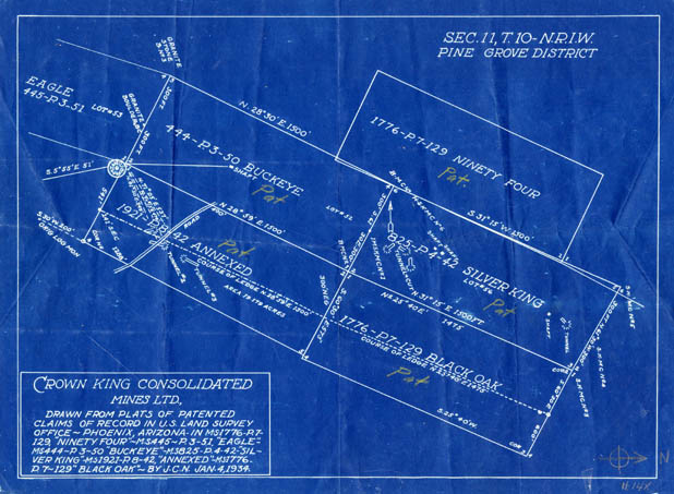
Map 148 -- Crown King Consolidated Mines
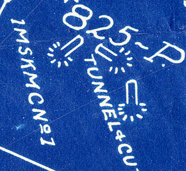
Detail
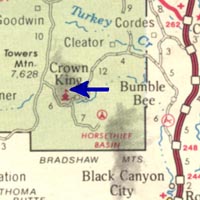
Location
Map 148 -- Crown King Consolidated Mines |
Detail |
|
|
|
|
Location |
|
|
|
Order |
| SCALE | 3600 | DATE | 1934 |
|---|---|---|---|
| AUTHOR | PUBLISHER | ||
| WIDTH X HEIGHT | 14 x 10 in. | FORMAT | Blueprint |
| PIXELS | 4121 x 3020 | RESOLUTION | 300 dpi |
| DIGITAL FILE | map0148.tif | SIZE & COLOR | 36 Mb RGB |
| ACCESSION NO. | CALL NO. | Map #148 | |
| LOCATION | Small maps box |
Shows mine plats for Ninety Four, Eagle, Buckeye, Silver King, Annexed and Black Oak mines.
Located in Section 11, T10N, R1W in the Pine Grove District. Map orientation: west on top.
Coordinates W1122020 N0341340 Crown King quad.
Museum | Archives | Maps |
|