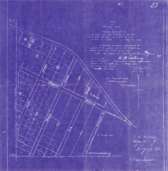
Map 167 -- Forbing Park plat
Detail
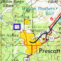
Location
Map 167 -- Forbing Park plat |
Detail |
|
|
|
|
Location |
|
|
|
Order |
| SCALE | 2400 | DATE | 1926 |
|---|---|---|---|
| AUTHOR | Forbing, A.H. | PUBLISHER | |
| WIDTH X HEIGHT | 17 x 17 in. | FORMAT | digital file only |
| PIXELS | 4953 x 5065 | RESOLUTION | 300 dpi |
| DIGITAL FILE | map0167.tif | SIZE & COLOR | 72 Mb RGB |
| ACCESSION NO. | CALL NO. | Map #167 | |
| LOCATION |
Plat map of Forbing Park NW of Prescott with dedication of streets and alleys.
Museum | Archives | Maps |
|