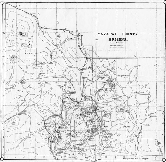
Map 21 -- Yavapai County, Arizona
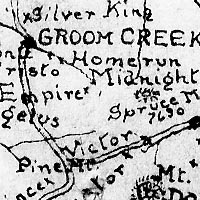
Detail
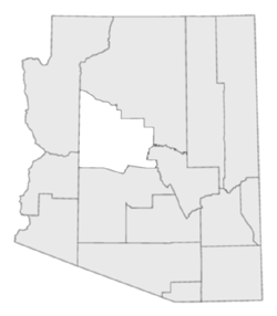
Location
Map 21 -- Yavapai County, Arizona |
Detail |
|
|
|
|
Location |
|
|
|
Order |
|
| SCALE | 380000 | DATE | 1903 |
|---|---|---|---|
| AUTHOR | Haggott, E.A. Richards, C.H. |
PUBLISHER | E.A. Haggott |
| WIDTH X HEIGHT | 18 x 18 in | FORMAT | |
| PIXELS | 5681 x 5513 | RESOLUTION | 300 dpi |
| DIGITAL FILE | map0021.tif | SIZE & COLOR | 30 Mb grayscale |
| ACCESSION NO. | CALL NO. | Map #21 | |
| LOCATION |
Shows roads, railroads, streams, mountains, mines and mining districts.
Relief shown by contours with 1000 foot interval.
Museum | Archives | Maps |
|