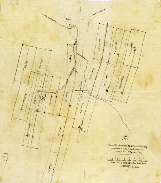
Map 265 -- Turkey Creek Mining District
Detail
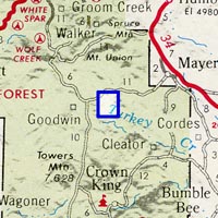
Location
Map 265 -- Turkey Creek Mining District |
Detail |
|
|
|
|
Location |
|
|
|
Order |
| SCALE | 2400 | DATE | 1903 |
|---|---|---|---|
| AUTHOR | Sharp, J.M. | PUBLISHER | |
| WIDTH X HEIGHT | 32 x 37 in. | FORMAT | Ink drawing on cloth |
| PIXELS | 6515 x 7371 | RESOLUTION | 300 dpi |
| DIGITAL FILE | map0265.tif | SIZE & COLOR | 137 Mb RGB |
| ACCESSION NO. | CALL NO. | Map #265 | |
| LOCATION |
Corona Consolidated Gold and Copper Company mine plats near Goodwin and Pine Flat, on Pine Creek.
Mine names: Copper Hill; Corona; Josephine; Hazel; Silver Bill; Gold Bill; Deers Rest; Christmas Gift; The Great and Only; Sport.
Museum | Archives | Maps |
|