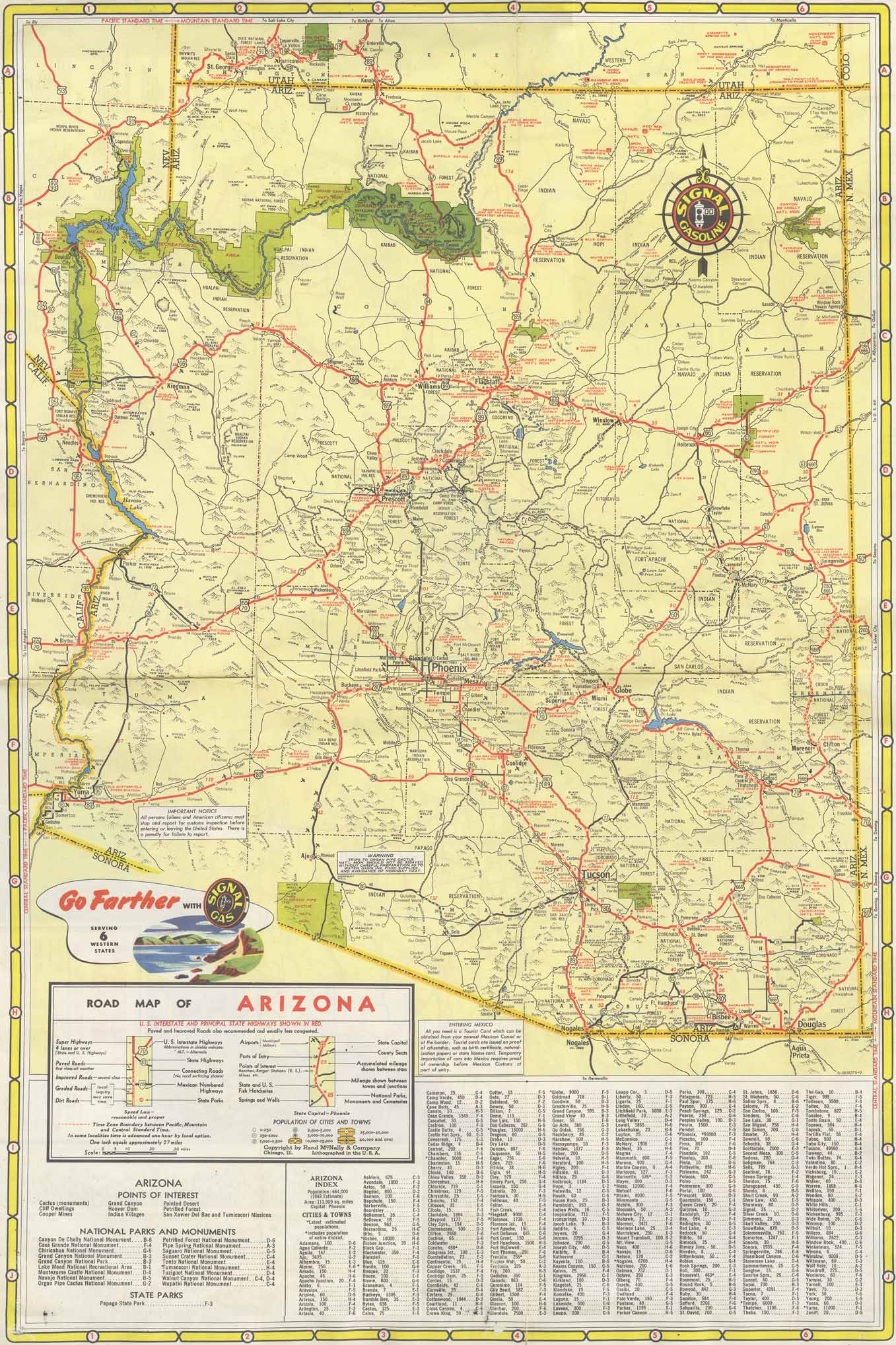
Map 270 -- Signal Highway Map California Arizona Nevada
Detail
Mapped area
Map 270 -- Signal Highway Map California Arizona Nevada |
Detail |
|
|
|
|
Mapped area |
|
|
|
Map is subject to copyright and cannot be ordered.
|
| SCALE | 1710000 | DATE | c.1950 |
|---|---|---|---|
| AUTHOR | PUBLISHER | Rand McNally | |
| WIDTH X HEIGHT | 28 x 21 in.. | FORMAT | printed two sides |
| PIXELS | 4070 x 6108 | RESOLUTION | 300 dpi |
| DIGITAL FILE | map0270.tif | SIZE & COLOR | 71 Mb RGB |
| ACCESSION NO. | CALL NO. | Map #270 | |
| LOCATION |
Map shows California and Nevada on one side, Arizona and major cities on the other.
Museum | Archives | Maps |
|