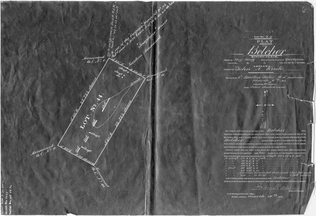
Map 279 -- Belcher Mining Claim
Detail
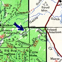
Location
Map 279 -- Belcher Mining Claim |
Detail |
|
|
|
|
Location |
|
|
|
Order |
| SCALE | 3100 | DATE | 1880 |
|---|---|---|---|
| AUTHOR | PUBLISHER | U.S. Surveyor General | |
| WIDTH X HEIGHT | 17 x 12 in. | FORMAT | |
| PIXELS | 5257 x 3595 | RESOLUTION | 300 dpi |
| DIGITAL FILE | map0279.tif | SIZE & COLOR | 18 Mb grayscale |
| ACCESSION NO. | 81.83 | CALL NO. | Map #279 |
| LOCATION |
Claimed by John A. Rush. Includes shaft data, patent date and number.
Coordinates W1121930 N0342715 Poland Junction quad.
Museum | Archives | Maps |
|