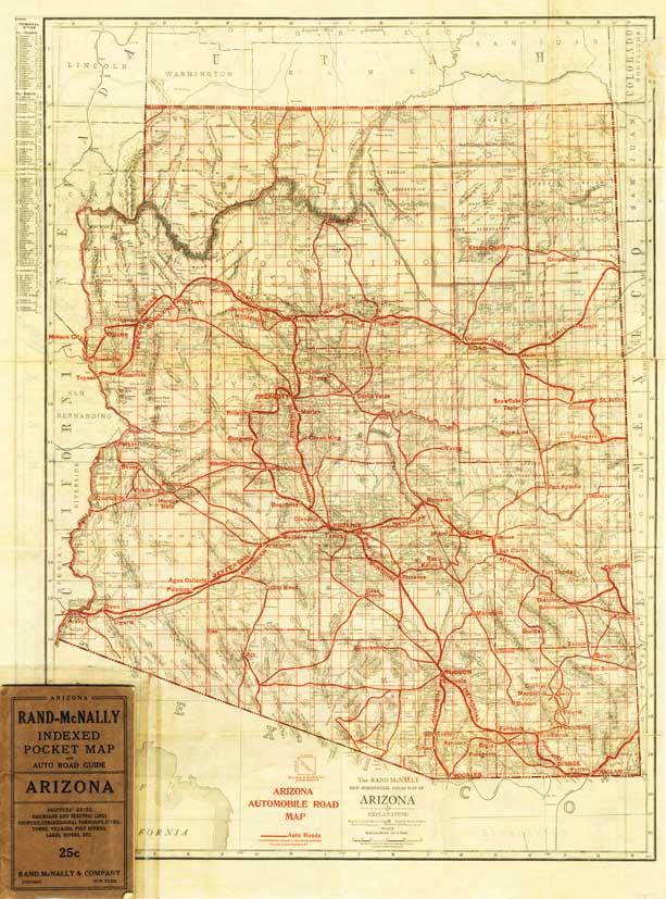
Map 287 -- Rand McNally New Commercial Atlas map of Arizona -- Automobile Roads
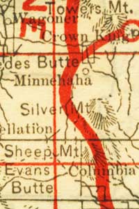
Detail
Map 287 -- Rand McNally New Commercial Atlas map of Arizona -- Automobile Roads |
Detail |
|
|
|
|
Order |
| SCALE | 1204000 | DATE | 1919 |
|---|---|---|---|
| AUTHOR | PUBLISHER | Rand McNally | |
| WIDTH X HEIGHT | 21 x 28 in. | FORMAT | color |
| PIXELS | 6131 x 8274 | RESOLUTION | 300 dpi |
| DIGITAL FILE | map0287.tif | SIZE & COLOR | 145 Mb RGB |
| ACCESSION NO. | CALL NO. | Map #287 | |
| LOCATION |
Map 286 is printed on reverse.
Auto roads are printed in red and are imaginary.
For example, Prescott to Phoenix via Minnehaha (see detail).
Map was originally folded into pocket bottom left.
Museum | Archives | Maps |
|