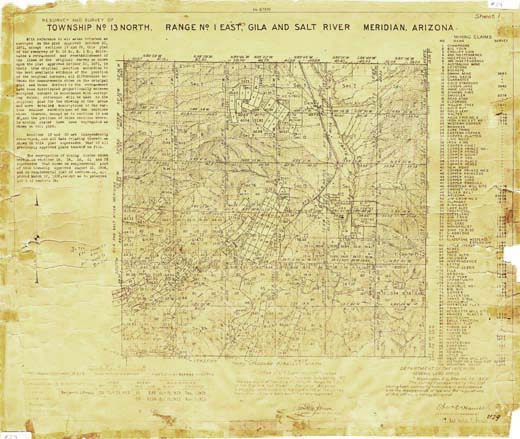
Map 29 -- Township 13N, Range 1E, Gila and Salt River Meridian, Arizona
Detail
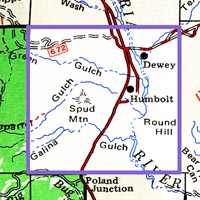
Location
Map 29 -- Township 13N, Range 1E, Gila and Salt River Meridian, Arizona |
Detail |
|
|
|
|
Location |
|
|
|
Order |
| SCALE | 31680 | DATE | 1928 |
|---|---|---|---|
| AUTHOR | PUBLISHER | U.S. Dept. of the Interior | |
| WIDTH X HEIGHT | 21 x 18 in. | FORMAT | |
| PIXELS | 12428 x 10262 | RESOLUTION | 600 dpi |
| DIGITAL FILE | map0029.tif | SIZE & COLOR | 365 Mb RGB |
| ACCESSION NO. | CALL NO. | Map #29 | |
| LOCATION |
Resurvey of Township 13N, Range 1E, includes 102 mining claims with index and
survey numbers.
Area includes Dewey, Humboldt and the McCabe mining region.
Museum | Archives | Maps |
|