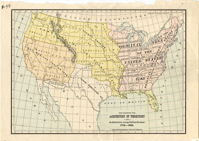
Map 38 -- Showing the Acquisition of Territory and its Distribution Among Political Divisions 1776-1885
Detail
Map 38 -- Showing the Acquisition of Territory and its Distribution Among Political Divisions 1776-1885 |
Detail |
|
|
|
|
Order |
|
| SCALE | 21000000 | DATE | 1887 |
|---|---|---|---|
| AUTHOR | PUBLISHER | ||
| WIDTH X HEIGHT | 11 x 7in. | FORMAT | color print |
| PIXELS | 3236 x 2288 | RESOLUTION | 300 dpi |
| DIGITAL FILE | map0038.tif | SIZE & COLOR | 21 Mb RGB |
| ACCESSION NO. | CALL NO. | Map #38 | |
| LOCATION | Small maps box |
"Prepared Expressly for Fremont's Memoirs"
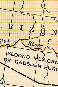
Shows the second Mexican cession or Gadsden Purchase of 1853.
Museum | Archives | Maps |
|