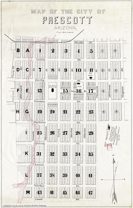
Map 41 -- Map of the City of Prescott
Detail
Location
Map 41 -- Map of the City of Prescott |
Detail |
|
|
|
|
Location |
|
|
|
Order |
| SCALE | 2400 | DATE | c1894 |
|---|---|---|---|
| AUTHOR | PUBLISHER | Prescott Title Company | |
| WIDTH X HEIGHT | 25 x 36 in. | FORMAT | Black with red highlights |
| PIXELS | 6600x 10312 | RESOLUTION | 300dpi |
| DIGITAL FILE | map0041.tif | SIZE & COLOR | 195 Mb RGB |
| ACCESSION NO. | CALL NO. | Map #41 | |
| LOCATION |
Map of projected city lots and streets. Includes Granite Creek and portion of railroad.
Two copies.
Museum | Archives | Maps |
|