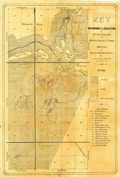
Map 48 -- Eureka Mining District
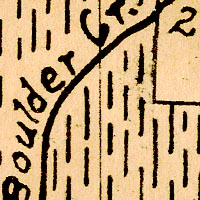
Detail
Location
Map 48 -- Eureka Mining District |
Detail |
|
|
|
|
Location |
|
|
|
Order |
| SCALE | 36000 | DATE | 1929 |
|---|---|---|---|
| AUTHOR | Wood, Homer R. | PUBLISHER | Homer R. Wood |
| WIDTH X HEIGHT | 16 x 23 in. | FORMAT | |
| PIXELS | 4814 x 6997 | RESOLUTION | 300 dpi |
| DIGITAL FILE | map0048.tif | SIZE & COLOR | 96 Mb RGB |
| ACCESSION NO. | CALL NO. | Map #48 | |
| LOCATION |
|
"Key Showing Location of Mining Properties in Western Yavapai County, Arizona in Eureka Mining District." Includes key to geology in what is now the Bagdad area. Claim groups listed: Hillside, Resurgum, Lawler & Howell, Comstock & Dexter, Goodenough, Cuprum, Bagdad Copper Corp., J.W. Dougherty, Copper King, Mammoth, Old Camp, Old Nick, Mt. Spring, Copper Queen, Red Cloud, Eureka. |
Museum | Archives | Maps |
|