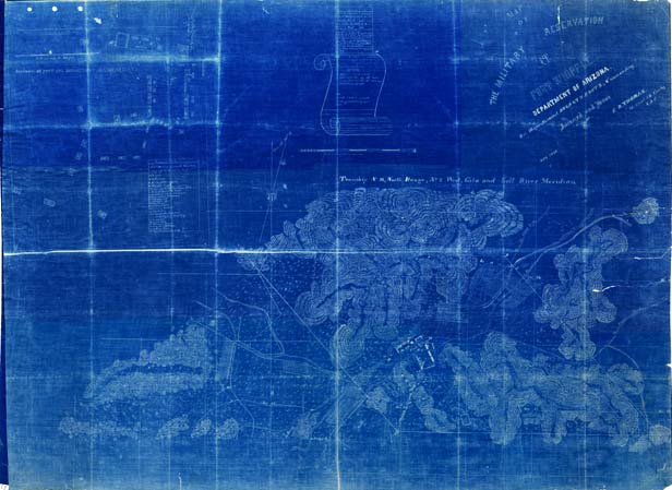
Map 55 -- Military Reservation at Fort Whipple
Detail

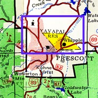
Location
Map 55 -- Military Reservation at Fort Whipple |
Detail |
|
|
|
|
Location |
|
|
|
Order |
| SCALE | 7920 | DATE | 1875 |
|---|---|---|---|
| AUTHOR | Thomas, E.D. | PUBLISHER | Department of Arizona |
| WIDTH X HEIGHT | 40 x 30 in. | FORMAT | Blueprint |
| PIXELS | 11977 x 8922 | RESOLUTION | 300 dpi |
| DIGITAL FILE | map0055.tif | SIZE & COLOR | 306 Mb RGB |
| ACCESSION NO. | CALL NO. | Map #55 | |
| LOCATION |
|
Map of Fort Whipple surveyed and drawn by E.D. Thomas while under command of August V. Kautz. Contains inset diagram of post and department headquarters with identification of structures. Includes affidavits of receipt, 1925, map0055a and map0055b. |
Museum | Archives | Maps |
|