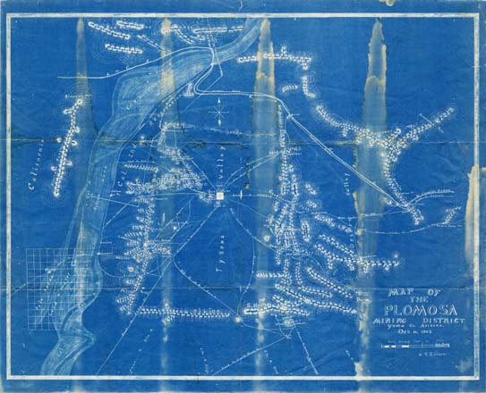
Map 60 -- Plomosa Mining District, Yuma Co. Arizona
Detail

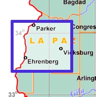
Location
Map 60 -- Plomosa Mining District, Yuma Co. Arizona |
Detail |
|
|
|
|
Location |
|
|
|
Order |
| SCALE | 126720 | DATE | 1908 |
|---|---|---|---|
| AUTHOR | Keiser, W.G. | PUBLISHER | |
| WIDTH X HEIGHT | 36 x 30 in. | FORMAT | Blueprint |
| PIXELS | 10702 x 8726 | RESOLUTION | 300 dpi |
| DIGITAL FILE | map0060.tif | SIZE & COLOR | 267 Mb RGB |
| ACCESSION NO. | CALL NO. | Map #60 |
|
Includes mines, mountains, railroads, wagon roads, Colorado River, Indian reservation, springs and wells. Quartzsite is prominent at the center of the map. |
|||
| LOCATION |
|---|
Museum | Archives | Maps |
|