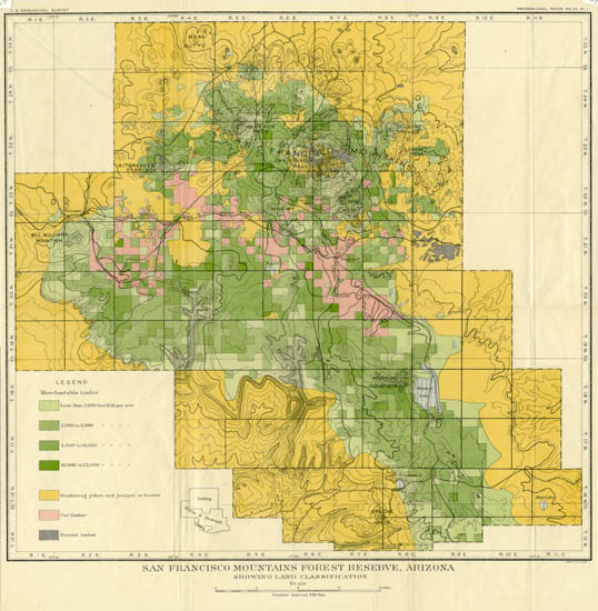
Map 654 -- San Francisco Mountains Forest Reserve
Detail
Location
Map 654 -- San Francisco Mountains Forest Reserve |
Detail |
|
|
|
|
Location |
|
|
|
Order |
| SCALE | 256000 | DATE | c1900 |
|---|---|---|---|
| AUTHOR | PUBLISHER | United States Geological Survey | |
| WIDTH X HEIGHT | 18 x 19 in. | FORMAT | color |
| PIXELS | 5383 x 5501 | RESOLUTION | 300 dpi |
| DIGITAL FILE | map0654.tif | SIZE & COLOR | 85 Mb RGB |
| ACCESSION NO. | CALL NO. | Map #654 | |
| LOCATION |
Shows land classifications of timber. Contour interval 250 feet. Includes railroads, roads and lakes.
Shows township and range numbers.
Museum | Archives | Maps |
|