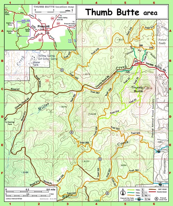
Map 659 -- Thumb Butte Area
Detail
Location
Map 659 -- Thumb Butte Area |
Detail |
|
|
|
|
Location |
|
|
|
Order |
| SCALE | 17500 | DATE | 2008 |
|---|---|---|---|
| AUTHOR | Derek Brownlee | PUBLISHER | US Department of Agriculture |
| WIDTH X HEIGHT | 11 x 17 in. | FORMAT | color |
| PIXELS | 3858 x 4601 | RESOLUTION | 343 dpi |
| DIGITAL FILE | map0659.tif | SIZE & COLOR | 51 Mb RGB |
| ACCESSION NO. | 2014.109 | CALL NO. | Map #659 |
| LOCATION |
Prescott National Forest brochure 12 x 18 in. printed both sides and folded to 4 x 9 in.
Digital file is the original from which brochure was printed.
Museum | Archives | Maps |
|