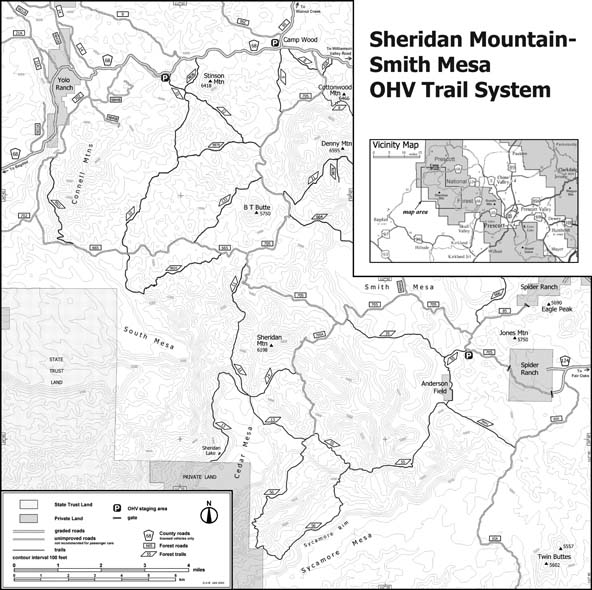
Map 660 -- Sheridan Mountain - Smith Mesa Off-Highway Vehicle Trail System
Detail
Location
Map 660 -- Sheridan Mountain - Smith Mesa Off-Highway Vehicle Trail System |
Detail |
|
|
|
|
Location |
|
|
|
Order |
| SCALE | 58000 | DATE | 2003 |
|---|---|---|---|
| AUTHOR | Derek Brownlee | PUBLISHER | US Department of Agriculture |
| WIDTH X HEIGHT | 15 x 18 in. | FORMAT | |
| PIXELS | 3828 x 3814 | RESOLUTION | 259 dpi |
| DIGITAL FILE | map0660.tif | SIZE & COLOR | 14 Mb grayscale |
| ACCESSION NO. | 2014.109 | CALL NO. | Map #660 |
| LOCATION |
Prescott National Forest brochure 15 x 18 in. printed both sides and folded to 4 x 9 in.
Digital file is the original from which brochure was printed.
Museum | Archives | Maps |
|