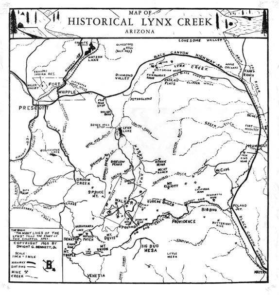
Map 71 -- Map of Historical Lynx Creek
Detail
Location
Map 71 -- Map of Historical Lynx Creek |
Detail |
|
|
|
|
Location |
|
|
|
|
| SCALE | 63360 | DATE | 1965 |
|---|---|---|---|
| AUTHOR | Bennett, D.G. | PUBLISHER | |
| WIDTH X HEIGHT | 16 x 17 in. | FORMAT | |
| PIXELS | 4916 x 5197 | RESOLUTION | 300 dpi |
| DIGITAL FILE | map0071.tif | SIZE & COLOR | 24 Mb grayscale |
| ACCESSION NO. | CALL NO. | Map #71 | |
| LOCATION |
|
Historical map of the area between Prescott and Mayer, showing mines, creeks and railroads. Refers to the book: The Many Lives of the Lynx. |
Museum | Archives | Maps |
|