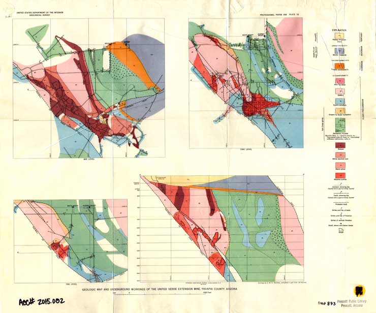
Map 893 - Geologic map and underground workings of the United Verde Extension Mine
Detail
Location
Map 893 - Geologic map and underground workings of the United Verde Extension Mine |
|
|
|
Detail |
Location |
|
|
Order |
|
| SCALE | 2400 | DATE | 1958 |
|---|---|---|---|
| AUTHOR | PUBLISHER | U.S. Geological Survey | |
| WIDTH X HEIGHT | 25 x 21 in. | FORMAT | color |
| PIXELS | 7398 x 6157 | RESOLUTION | 300 dpi |
| DIGITAL FILE | map0893.tif | SIZE & COLOR | 130 Mb RGB |
| ACCESSION NO. | 2015.002 | CALL NO. | Map #893 |
| LOCATION |
|
Originally published as Plate 10 in:
|
Museum | Archives | Maps |
|