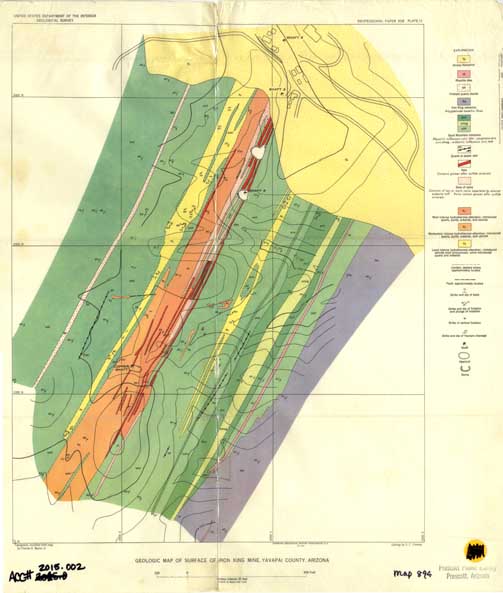
Map 894 -- Geologic map of surface of Iron King Mine
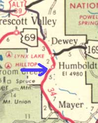
Detail

Location
Map 894 -- Geologic map of surface of Iron King Mine |
Detail |
|
|
|
|
Location |
|
|
|
Order |
| SCALE | 2400 | DATE | 1958 |
|---|---|---|---|
| AUTHOR | PUBLISHER | U.S. Geological Survey | |
| WIDTH X HEIGHT | 17 x 20 in. | FORMAT | color |
| PIXELS | 5025 x 5925 | RESOLUTION | 300 dpi |
| DIGITAL FILE | map0894.tif | SIZE & COLOR | 85 Mb RGB |
| ACCESSION NO. | 2015.002 | CALL NO. | Map #894 |
| LOCATION |
Originally published as Plate 11 in:
|
Museum | Archives | Maps |
|