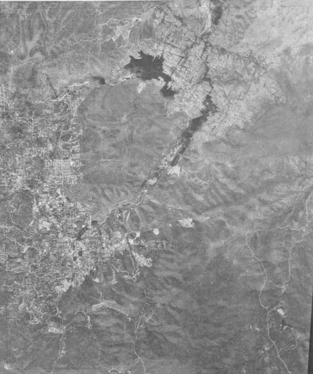
Map 912 -- Aerial Map of Prescott
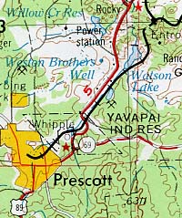
Detail

Mapped area
Map 912 -- Aerial Map of Prescott |
Detail |
|
|
|
|
Mapped area |
|
|
|
Order |
| SCALE | 24000 | DATE | 1973 |
|---|---|---|---|
| AUTHOR | PUBLISHER | ||
| WIDTH X HEIGHT | 22 x 29 in. | FORMAT | |
| PIXELS | 5895 x 7057 | RESOLUTION | 300 dpi |
| DIGITAL FILE | map0912.tif | SIZE & COLOR | 40 Mb grayscale |
| ACCESSION NO. | CALL NO. | Map #912 | |
| LOCATION |
An exact overlay of the Prescott 1:24000 topographic quad, Map# 64.274, published the same year.
Museum | Archives | Maps |
|