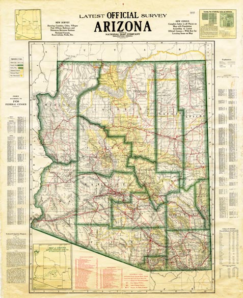
Map 937 -- Latest Official Survey, Arizona
Detail
View in Sharlot Hall Museum Archives only
Map 937 -- Latest Official Survey, Arizona |
Detail |
|
|
|
|
| Map is subject to copyright and cannot be ordered. View in Sharlot Hall Museum Archives only |
| SCALE | 725000 | DATE | 1932 |
|---|---|---|---|
| AUTHOR | PUBLISHER | National Map Co., Indianapolis | |
| WIDTH X HEIGHT | 40 x 49 in. | FORMAT | Color |
| PIXELS | 5963 x 7318 | RESOLUTION | 150 dpi |
| DIGITAL FILE | map0937.tif | SIZE & COLOR | 125 Mb RGB |
| ACCESSION NO. | CALL NO. | Map #937 | |
| LOCATION |
|
NEW SURVEY Showing Counties, Cities, Villages, Post Offices, Railways and Distances Between Stations, National Forests, Reservations, Parks, Etc." |
Museum | Archives | Maps |
|