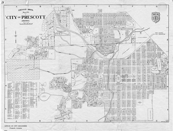
Map 28 -- Thomas Brothers Map of the City of Prescott Arizona
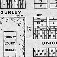
Detail
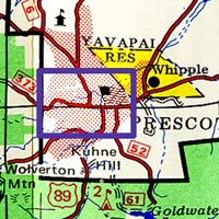
Location
Map 28 -- Thomas Brothers Map of the City of Prescott Arizona |
Detail |
|
|
|
|
Location |
|
|
|
Map is subject to copyright and cannot be ordered.
|
| SCALE | 7500 | DATE | 1930 |
|---|---|---|---|
| AUTHOR | Thomas, G.C. | PUBLISHER | Thomas Bros. |
| WIDTH X HEIGHT | 22 x 17 in. | FORMAT | |
| PIXELS | 6592 x 5048 | RESOLUTION | 300 dpi |
| DIGITAL FILE | map0028.tif | SIZE & COLOR | 95 Mb RGB |
| ACCESSION NO. | CALL NO. | Map #28 | |
| LOCATION |
|
Indicates city boundaries and subdivisions with lots, government buildings, schools, cemeteries, creeks, and railroad property. Includes index of streets. See also 1936 edition Map #73. See also Map #797 which is not copyright and can be ordered. |
Museum | Archives | Maps |
|