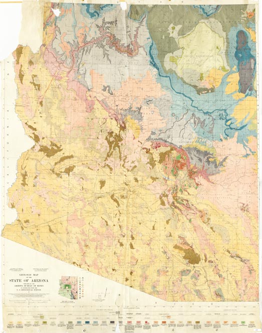
Map 69 -- Geologic Map of the State of Arizona
Detail
Map 69 -- Geologic Map of the State of Arizona |
Detail |
|
|
|
|
Order |
|
| SCALE | 500000 | DATE | 1924 |
|---|---|---|---|
| AUTHOR | Darton, N.H. | PUBLISHER | Arizona Bureau of Mines |
| WIDTH X HEIGHT | 43 x 56 in. | FORMAT | Color |
| PIXELS | 6538 x 8298 | RESOLUTION | 150 dpi |
| DIGITAL FILE | map0069.tif | SIZE & COLOR | 155 Mb RGB |
| ACCESSION NO. | CALL NO. | Map #69 | |
| LOCATION | Hanging |
|
Produced in cooperation with U.S. Geological Survey. Based on topographic map 67. Includes index map of sources. |
Museum | Archives | Maps |
|