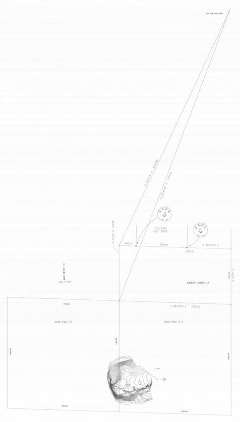
Map 182.2 -- Green Horn and Gold Star mine survey
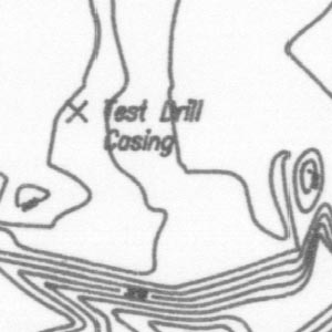
Detail
Location
Map 182.2 -- Green Horn and Gold Star mine survey |
Detail |
|
|
|
|
Location |
|
|
|
Order |
| SCALE | 1800 | DATE | c.1990 |
|---|---|---|---|
| AUTHOR | PUBLISHER | ||
| WIDTH X HEIGHT | 19 x 33 in. | FORMAT | |
| PIXELS | 5707 x 10035 | RESOLUTION | 300 dpi |
| DIGITAL FILE | map0182.2.tif | SIZE & COLOR | 55 Mb grayscale |
| ACCESSION NO. | CALL NO. | Map #182.2 | |
| LOCATION |
Extension of map #182.1 to include Gold Star #1 and #2 and contours of tailings.
See also maps 146, 182.3, 182.4.
Museum | Archives | Maps |
|