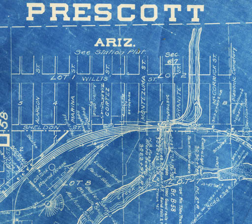
We have a fairly complete collection of Santa Fe right-of-way track maps from 1915 with revisions, running from Ash Fork through Prescott to Phoenix, with branches to Clarkdale and Mayer. The Prescott Depot is shown above, with a larger station plat available. Maps are 1:4800 scale, with four miles of track shown on 56 x 24 inch sheets. Station plats are 1:1200 scale.
| Map# | Scale | Date | Title |
|---|
   340    253440   1916   Index map to RR track maps of Ash Fork-Prescott-Phoenix branch
                          operated by Atchison, Topeka and Santa Fe Railway
Ash Fork to Prescott:
   341.01   4800   1921   sheet 1 of 15   Ash Fork
   341.015  4800   1930   sheet 1 rerouting
   341.02   4800   1915   sheet 2 of 15   Cruice to Meath Wash
   341.04   4800   1930   sheet 4 of 15   Little Hell Canyon
   341.06   4800   1924   sheet 6 of 15   Drake, Clarkdale junction, Hell Canyon
   341.07   4800   1915   sheet 7 of 15   Paulden realignment area
   341.08   4800   1928   sheet 8 of 15, and map#401.08 1960 update.  Paulden/Abra realignment
   341.09   4800   1934   sheet 9 of 15,  Puro, Del Rio and map#401.09 1971 update.
   341.10   4800   1971   sheet 10 of 15, updated series. Former Jerome Junction
   341.11   4800   1924   sheet 11 of 15, and map#401.11 1950 update.
   341.12   4800   1924   sheet 12 of 15, Granite siding to airport and map#401.12 1984 update.
   341.13   4800   1921   sheet 13 of 15, Granite Creek trestle, P&E junction at Point of Rocks and map#401.13 1983 update.
   341.14   4800   1934   sheet 14 of 15, Granite Dells to Fort Whipple and map#401.14 1986 update
   341.15   4800   1923   sheet 15 of 15, and map#401.15 1984 update. Prescott to Iron Springs Road

Prescott to Phoenix:
   342.01   4800   1923   sheet 1 of 35.  Same as 341.15 (Prescott)
   342.02   4800   1922   sheet 2 of 35   Kingswood, Emmanuel Pines
   342.03   4800   1924   sheet 3 of 35   Alto summit and Iron Springs resort
   342.04   4800   1920   sheet 4 of 35   Doce
   342.06   4800   1922   sheet 6 of 35   Skull Valley north
   342.07   4800   1924   sheet 7 of 35   Skull Valley south
   342.09   4800   1931   sheet 9 of 35   West of Kirkland
   342.10   4800   1934   sheet 10 of 35  Bells Canyon and Grand View
   342.11   4800   1932   sheet 11 of 35
   342.12   4800   1926   sheet 12 of 35  Hillside. Station detail on map342.125
   342.13   4800   1932   sheet 13 of 35
   342.14   4800   1934   sheet 14 of 35  Date
   342.16   4800   1931   sheet 16 of 35  Piedmont
   342.17   4800   1932   sheet 17 of 35  Congress
   342.18   4800   1937   sheet 18 of 35
   342.19   4800   1932   sheet 19 of 35  Flores
   342.21   4800   1924   sheet 21 of 35  Wickenburg
   342.22   4800   1936   sheet 22 of 35  Hassayampa River
   342.23   4800   1923   sheet 23 of 35
   342.24   4800   1940   sheet 24 of 35  Morristown, Castle Hot Springs station
   342.25   4800   1932   sheet 25 of 35  Circle City
   342.26   4800   1932   sheet 26 of 35  Wittmann
   342.27   4800   1932   sheet 27 of 35
   342.28   4800   1929   sheet 28 of 35  McMicken Dam
   342.29   4800   1925   sheet 29 of 35  Beardsley
   342.30   4800   1920   sheet 30 of 35  Surprise, El Mirage, Agua Fria River
   342.31   4800   1934   sheet 31 of 35  Peoria
   342.32   4800   1925   sheet 32 of 35  Peoria to Glendale
   342.33   4800   1935   sheet 33 of 35  Glendale to Alhambra
   342.34   4800   1920   sheet 34 of 35  Alhambra to Phoenix
   342.35   4800   1922   sheet 35 of 35  Phoenix

Entro to Mayer:
   350.1    4800   1980   sheet 1 of 7    Entro to Prescott Valley. Route of present Iron King Trail. Index to seven sheets.
   350.2    4800   1981   sheet 2 of 7    Prescott Valley to Yaeger
   350.3    4800   1980   sheet 3 of 7    Yaeger to present 69/Fain/PCC intersection
   350.4    4800   1987   sheet 4 of 7    69 to Humboldt
   350.5    4800   1980   sheet 5 of 7    Humboldt and sidings, Iron King Mine
   350.6    4800   1965   sheet 6 of 7    Poland Junction
   350.7    4800   1965   sheet 7 of 7    Mayer

Verde Valley Railway:
   360.05   4800   1932   sheet 5 of 10   Perkinsville
   360.06   4800   1916   sheet 6 of 10
   360.07   4800   1950   sheet 7 of 10   Mormon Pocket to Sycamore
   360.08   4800   1916   sheet 8 of 10

Station maps:
   342.125  1200   1928   Hillside Station Plat
   343      1200   1915   Phoenix Station Plat
   344      1200   1932   Phoenix Fairgrounds RR track map
   345      1200   1947   Phoenix Station Plat (Union Depot)
   346      1200   1935   Prescott Station Grounds
   347      1200   1987   Prescott Station Map
   348      1200  c1985   AT&SF Railroad Alignment through Prescott
   349      1200   1916   Prescott Station Plat
   351      1200   1917   Mayer Station Plat
   361      1200   1925   Clarkdale Station Plat -- north half
   402      1200   1958   Granite Station Map
   403      1200   1971   Puro Station Map
   404      1200  c1930   Ash Fork Station (incomplete)
   405      1200  c1930   Wickenburg Station (incomplete)
   407      1200   1921   Tapco Station Plat, Verde Valley Railway
   408      1200   1921   Mack Station Plat, Verde Valley Railway
   409      1200   1915   Bear Station Plat, Verde Valley Railway
   410      1200   1915   Sycamore Station Plat, Verde Valley Railway
   411      1200   n.d.   Prescott Depot to Fort Whipple with electrical overlay

Other railroad maps:
   54     950000   1861   Surveys for a Railroad Route from the Rio Grande to the Pacific Ocean
   90     940000   1858   Preliminary map of the western portion of the reconnaissance and survey for a Pacific rail road route near the 35th par.
  113    1774000   1899   Rand, McNalley & Co.'s Arizona Railroads
  114    1774000   1907   Rand, McNalley & Co.'s Arizona Railroads
  144     210000   1983   Notice of abandonment of Santa Fe Railway Abra to Prescott branch line
  215    4560000   1905   Mexico with list of railroads, Greene Consolidated Gold Company
  254    2772000   1881   "Our Country" A New Illustrated County Railroad and Distance Map of the United States and Dominion of Canada, with map of world on reverse.
  286    1204000   1919   Rand McNally New Commercial Atlas map of Arizona -- Railroads
  300       n.s.   1984   Railroad maps, Prescott, Jerome, Flagstaff
  304       n.s.   1982   Railroad maps, Verde Valley and Williams
  315      24000   1902   P.& E.R.R. Located Line Big Bug Branch from Huron to Poland-Hamilton Mine
  316      24000   1900   P.[& E.]R.R. Located Line from Mayer to Crowned King Ariz.
  317      24000   1900   B.M.R.R. Located Line from Mayer to Crowned King Ariz. with affidavit 1904

  626       2400   1966   T14N R2W Section 13 tracts, lots and subdivisions, Watson Lake and RR ROW
  793     510000   1905   Map Showing the Location of the Road and the Land Grant of the Santa Fe Pacific Railroad in Arizona
  796      39000   1882   14th-18th 25-mile Land Grant Sections, Atlantic and Pacific Railroad (5 sheets photocopied)

 1421      15840   1914   Colorado River Reservation showing projected route of electric railway through Mohave Indian allotments.
 1422      62000   1914   Colorado River Reservation showing projected route of electric railway.
 1424      24000   1912   Parker and Colorado River Railroad Section 1 from Parker Townsite to mile 19.75.
 1425      24000   1912   Parker and Colorado River Railroad Section 2 from mile 19.75 to mile 37.17.
 1426      24000   1899   Located and projected line of the Saginaw Southern Railroad
 1427      12000   1902   Preliminary survey for electric railway from Prescott to Walker, Arizona
 1428       2400  c1920   Plan of Electric Trolley Railway from Chaparral Station to the Gladstone Mine
 1429     826000   1904   Santa Fe, Prescott and Phoenix Railway and subsidiary and projected lines in Arizona
 1430     c60000  c1920   Railroad survey near Francis, Boulder and Burro Creeks (Bagdad)
 1431      c1200  c1905   Railroad tracks at Poland tunnel terminus
 1432      24000   1908   Canyon Copper Co. Rail Road (proposed for South Rim)

Books:
  385.06 SAY       1990   The Santa Fe, Prescott & Phoenix Railway by John W. Sayre.
  385.09 MYR       2001   Santa Fe to Phoenix by David F. Myrick.

ARCHIVES -- MAP COLLECTION